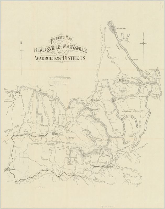
| acheron1928map.pdf |
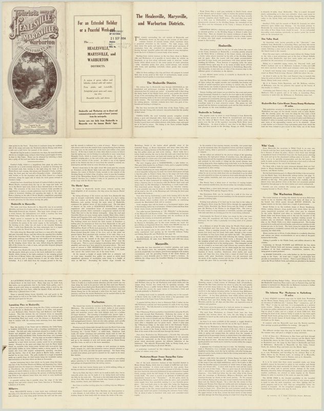
| warburton1928tourist.pdf |
Visit to the forgotten waterfalls of Deep Creek a tributary of the O'Shannassy River
Scaling East Wall of Acheron Valley
What Walkers Found
( By a Special Correspondent )
Tourists who have driven through the Acheron Valley, from Narbethong to Warburton, or have walked along the old pack track that rambled along, crossing tributary after tributary of the Acheron River, might have wondered what the valley was like off the beaten track, and what a closer view would reveal of the walls which the Great Dividing Range hems the valley.
My curiosity got the better of me and I found a curious formation, the Dividing Range, after reaching Mount Strickland, takes a sudden dip to the southward to within a few miles of Warburton and Mount Donna Buang then suddenly it turns to the north and passing over Mount Vinegar, crosses the Blacks Spur and resumes its normal east-west course over Mount Monda and St Leonard. Such a vicious bite southward of a northward flowing river provides something unusual for the tourist. The little track that wound southward from Narbethong in 1923 has been surplanted by the Acheron Way and something of the awe-inspiring nature of the trip through the valley has been lost. Still the valley provides new material for many holidays.
Track marked "indistinct"
In Easter 1929 we chose the East Wall. Those who know the tourist map of the district will recall a track marked on the map that starts from the Splitter's Camp near the extreme south of the valley and winds northward over the Divide to the summit of Mount Strickland.
This track has tantalisingly been marked " Track indistinct " by the tourist authorities and they warn that the track is overgrown and that they cannot advise you to attempt to follow it.
The beginning of this track is a few yards due east of the hut at Slitters Camp. After following it straight up the spur for about a mile, it lost itself completely in the undergrowth. The way was straight up the spur and we went on. After scrambling and pushing we reached the brow of the spur. The undergrowth suddenly petered out and gave way to snow grass and box, which formed a park like plateau land. There were several miles of this park-like land along this part of the Divide, and this stage of the journey is comparatively easy.
4250 feet up
Following the spur in a nor'-nor' easterly direction for about four miles brought us to the summit marked on the tourist map "4250" - the highest point in the district.
Once the spur from Splitters Camp is climbed the rise is gradual all the way to this summit. A car could negotiate with ease.
Halfway from the Splitters Camp Spur to the "4250" point a true plateau formally occurs where it seems that this spur makes a junction with the Dividing Range proper. An area a mile square seems to sweep gradually upward and concentrate on a certain point crowned with a cap of snow gums.
The area is covered with fallen timber, and the standing trunks of dead stunted gums like the dried skeletons of some arboreal shambles. The only living thing is the snow grass. Standing on the southern rim of this plateau one gets the impression that the whole earth is sweeping majestically upward to one central point.
After crossing this plateau, the top of the Divide, although still wide, is more normal in size. Although freely dotted with clumps of snow gums, the park like nature of the country continues until on the verge of a rapid descent northward, it culminated in the "4250" point.
Fine view through gums
Snow gums at present mar what would undoubtedly be the finest view point in the district. It is necessary to move from point to point to obtain views in different directions.
To the northward are the closely wooded top of Mount Strickland, on the left, the beginning of the Poley Ranges on the right, and between them the westerly portion of the O'Shannassy watershed.
Directly to the north over the Paradise Plains can be seen Mount Kitchener, beyond which lies Marysville and still further away Cathedral Mountain and the plains around Buxton. To the right of Mount Kitchener is mount Grant and Mount Arnold. Snowy Hill and Lake Mountain ridge stretching away to the north.
On the west of the "4250" point the immediate foreground is the steep valley of the Acheron looking more precipitous than ever from the perch on the eastern rim. Mount Vinegar rises directly opposite. Beyond Mount Vinegar lie Mounts Monda and St Leonard an Mount Macedon. South of these are the plains of Melbourne, Port Phillip Bay with the You Yangs in the distance.
Southward are the Acheron Gap through which we had come from Warburton and Mount Donna Buang with the lookout tower clear against the skyline.
Sudden dip
Continuing northward, the ridge of the Divide dips steeply. The dip ceases abruptly, after a mile, in an unbroken rise to Mount Strickland four or five miles further north. Our descent was hampered by fallen timber and dense clumps of snow gums.
The gap, at the foot of this descent, is a pleasant surprise. Tall trees with a carpet of snow grass, and walled on the north by a grove of beech trees, made a pleasing picture. This beech grove is on a spring which forms the headwaters of one of the many westward flowing tributaries of the Acheron river.
Our next objective was the falls on the headwaters of the southern most tributary of Deep creek in the O'Shannassy watershed. It is only a mile from the Gap but the country is tricky. Use of the compass and some head work got us there without much trouble.
The first part of this stage of the journey is through a desolate piece of fire swept country, thickly covered in fallen timber and dead gum saplings. The last stage is along a creek lined with beech trees until within 200 or 300 yards of the falls the creek joins the main stream.
Falls drop 200 feet
The falls have a total drop of more than 200 feet. Unlike Steavenson's falls Marysville, they lack the majesty of a single long fall, but leap from ledge to ledge in drops from four to twenty feet.
We climbed down the falls and up again. It is an exhilarating scramble and does not present any uncomfortable situations.
| acherontrackindistinct1922.pdf |
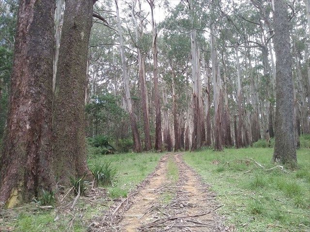
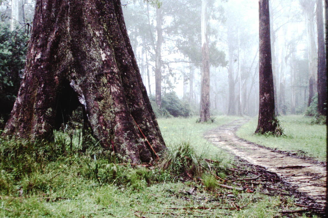
Photos above are near the 4250 feet point which is known as Mount Ritchie.

 RSS Feed
