Over the Baw Baws
To the Editor of the Argus
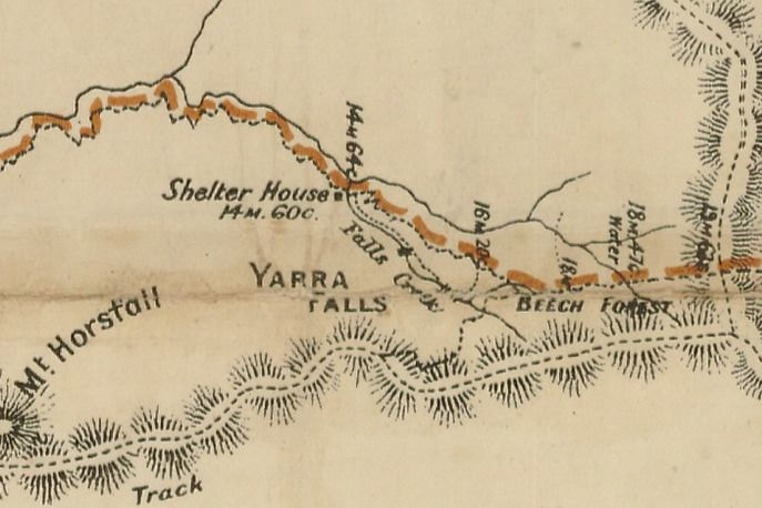
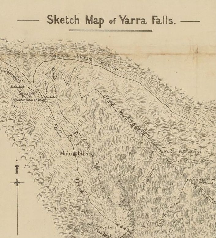
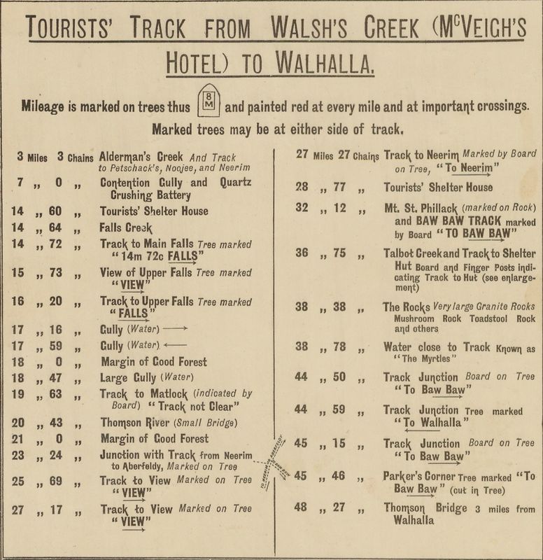
Sir, - May I direct the attention of tourists generally to the state of things prevailing on the track from Warburton to Walhalla over the Baw Baw Mountains? It is time that an accurate account of the journey was published to prevent tourists from entering on a arduous and disappointing trip. The chief incentive for making the journey are a handbook issued by the Victorian Railways and the map printed by the Department of Lands and Survey, both misleading. First of all, in regard to the actual track, the railway book says :- "The Lands and Public works department have cut a track, well defined and easily followed, and have erected three shelter sheds en route at convenient distances apart." The first part of this statement probably has some truth in it at first, but now conveys an utterly erroneous impression. At the head of the map we are told " Mileage is marked on trees and painted red at every mile, and at important crossings. Marked trees may be either side of the track. " Yes they maybe, but as a matter of fact, they are not. There are not more than six of the 50 odd miles of the journey marked off - the track, once made, having been neglected ever since, with the result that, owing to the fires which constantly ravage the country, one has frequently to climb over or go around dozens of large fallen tree-trunks to the mile - a tiresome operation with four days' provisions and bedding carried on the back. A certain 200 yards between Falls creek and the River Thompson takes nearly a quarter of an hour to negotiate for this reason. As a whole, the track is either obliterated by trees or is over rough, loose stones, which cut boots to pieces, or leads through stretches of morass, in which the hoofs of struggling pack horses have cut deep hole, and ruts, making walking extremely unpleasant, often involving long deviations. To the "townie" the difficulty of following the track must be great. In some places on the Plateau there are no blazes to be seen on the trees for miles, while one- continually comes across diverging tracks and dreads to take the wrong one. At a certain spot; 19 odd miles from McVeigh's, the track splits into two and there is absolutely nothing to prevent the unwary from taking the left hand to Matlock, he perhaps going 10 miles,before the mistake is found out. But the greatest objection of all is the real length of the journey. On this point even the two Government publications differ. The tourist should be informed that the distances on the map are as the crow flies from peak to peak, and are not the actual distances passed over by the traveller, who invariably has to descend into steep valleys. and toil up opposite slopes by circuitous deviations.
The huts themselves are of a most elementary type, the middle having mother earth for a floor. It and the Talbot creek shelter shed are on par for filthiness, particularly the latter. Hundreds of tins that once contained provisions are littered around the doors, forming ideal breeding grounds for blow flies and vermin, swarms of the former making a meal a most disgusting process, since they settle in droves on any food that is opened. A ganger should be sent through the track once or twice a season to clear the way, and clean up the immediate vicinity of the shelter sheds.
yours,
L.
| warburtontowalhallatouristmap1907.pdf |
| tourist_map_warburton_mt._baw_baw_walhalla.jpg |
| yarrafallstext2.pdf |
| victorianrailwayspicturesquevictoria.compressed__1_.pdf |
To the Editor of the Argus
Sir,- Having myself taken the trip from Warburton to Walhalla across the Baw Baws, I read " L's "letter with much interest, which was not unmixed with surprise. My companion and I commenced the trip on January 10, thus crossing the track subsequently to the great bulk of Christmas and New Year trippers. If anyone had left the track in disorder it would most certainly be these, yet not at any point did we find the offensive condition of things to prevail as described by " L ". Those unwritten laws which bind the fraternity of the track had been observed to perfection, and the cleanliness and considerateness of previous tenants of the shelter huts left nothing to be desired.
The track, as stated in the booklet issued by the Lands and Survey department is well defined, and easy followed. At no point could the veriest "townie" if he had his wits about him, lose his way. The blazes on the trees are large and of a highly distinctive shape, except on top of the plateau where for about 14 miles the timber is small and dead. Even here scrutiny will always reveal them to the anxious tourist. With regard to wondering off on a side track, such a prospect would only appeal to one with no eyes for the direction he was pursuing. The absence of blazes of the distinctive shape above mentioned would immediately commend itself to the ordinary observant if he were on the wrong track. The statement that no more than six mile-posts are marked is totally unfounded. For the first 23 and the last 14 miles - the exception being the stretch at the top of the plateau - the markings of the mileage is so plain and masterly as to be an object of comment among certain persons who have done the trip. With regard to the difficulty of negotiating the stretch between the Falls and the Thomson river, I recollect nothing. This part of the journey lives in my memory on account of the extreme beauty and magnificence of its timber. The shelter-houses are indeed primitive, but offer a haven of refuge to the weary and possibly half-frozen travellers. The liberal supply of stretchers and cooking utensils adds to their already substantial supply of comfort.
yours
Defender.

 RSS Feed
